How to play
- Goal
- Know the world’s volcanoes: their appearance, locations, heights, types and eruption history.
- How it ends
- Volcano Line ends on the third mistake or when its collection runs out; other competitions end after ten questions, placements or pairs.
- Record
- Most correct answers, then fastest answering time; Height Reserve keeps the most reserve, and Matching the fastest time with penalties, separately for each competition and collection.
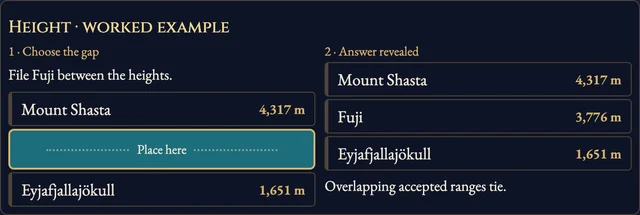
- Volcano Line: place volcanoes by summit elevation, highest at the top. Three mistakes end the run. Height Order scores ten placements; overlapping accepted ranges count as equal.
- Photo and Map: identify the pictured volcano or reference location from eight names. Countries and Volcano Type offer six choices; ten questions.
- Height Reserve: make ten summit-elevation estimates from 1,000 points. Inside an accepted range costs nothing; outside it, loss grows with distance to the nearest edge.
- Eruption Timeline: place ten particular eruption events, oldest at the top. The event is named; its year is hidden until you answer.
- Matching Table: choose a name and its photograph. Match ten pairs; each wrong pair adds three seconds.
- The clock starts once the question pictures are ready, counts open questions and stops on reveals. Help and settings keep it running. Leaving, hiding or restoring an unfinished run makes it practice.
Controls
| Tap / click | Choose an answer, a gap or a matching pair |
|---|---|
| 1–8 | Choose an answer |
| Arrow keys · Enter | Move between choices and confirm |
| H · R · Escape | How to play, restart, return |
Tips for Volcano Atlas
- Compare the whole volcano A crater, a cone and a caldera complex may have different heights and classifications. Use the named feature.
Questions about this game
Why are some competitions unavailable?
Each collection needs enough independently checked facts and distinct picture choices for a complete competition. A volcano can qualify for its photo but have an unknown or disputed height.
Which elevation is used?
The reported summit surface elevation above sea level, with the source period in the facts. It is not prominence or total height from the sea floor.
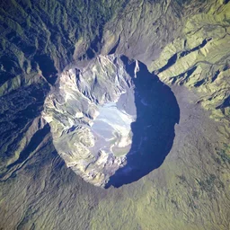
Volcanoes of the World, Global Volcanism Program (Smithsonian Institution), v. 5.4.0, compiled by Venzke, E. (2026). Independently maintained source facts and individually licensed photograph credits are linked in the game. Context maps: Natural Earth, public domain. No ads, SDKs or analytics inside the game. Title backdrop: Mount Tambora photograph by the NASA Expedition 20 crew, public domain.
About Volcano Atlas
A practice preview of nine volcano competitions, led by familiar volcanoes from every continent. Real photographs and reviewed reference maps accompany the questions.
Facts qualify separately: disputed elevations, ambiguous volcano types and unconfirmed eruptions stay out of scored questions. This preview saves your settings; attempts are practice while the complete atlas is being prepared.