How to play
- Goal
- Know the world’s lakes: their shapes, areas, depths, countries and outflows.
- How it ends
- Lake Line ends on the third mistake or when the collection runs out; other competitions end after ten questions, placements or pairs.
- Record
- Most correct answers, then fastest time; estimate competitions keep the most reserve, Matching the fastest time with penalties, separately for each competition and collection.
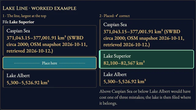
- Lake Line: place each lake by surface area, largest at the top; three mistakes end the run. Area Order and Depth Order score ten placements. Overlapping accepted ranges count as equal.
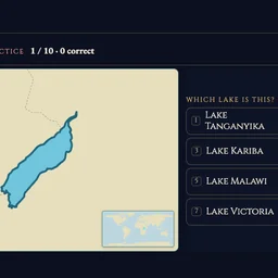
- Shape, Countries and Outflow: choose the correct lake name, shoreline country or direct receiving water from the displayed choices; ten questions.
- Area Reserve and Depth Reserve: make ten estimates from 1,000 points. Inside an accepted range costs nothing; outside it, loss grows with distance to the nearest edge.
- Matching Table: choose a lake name, then its outline. Match ten pairs; every wrong pair adds three seconds.
- The clock counts open questions and stops on reveals. Help and settings keep it running. Leaving or hiding an attempt makes it practice; uninterrupted runs can enter the named rankings.
Controls
| Tap / click | Choose an answer or a matching pair |
|---|---|
| 1–8 | Choose an answer |
| Arrow keys · Enter | Move between choices and confirm |
| H · R · Escape | How to play, restart, return |
| Standard controller | D-pad moves, A confirms, B goes back, Y opens help, Start opens settings |
Tips for Lakes Atlas
- Read the map Use the coastline, borders and world locator to identify the lake.
Questions about this game
Why are some competitions unavailable?
A collection needs enough independently verified facts for a complete competition. Each lake has a reviewed picture, but an unknown measurement, country set or outflow stays out of that question type.
Reviewed lake outlines: Natural Earth public domain, HydroLAKES v1.0 (Messager et al., CC BY 4.0), and © OpenStreetMap contributors (ODbL 1.0). Context maps and borders: Natural Earth. Independent fact and outline sources are linked in the game. No ads, SDKs or analytics in the game.
Watch how to play
About Lakes Atlas
Learn 351 independently reviewed lake outlines through nine competitions, with well-known lakes, six continents, natural lakes and reservoirs. Each eligible competition and collection has its own named Top Ten: 53 boards.
Facts qualify independently: 25 surface-area ranges, 24 maximum depths, 272 shoreline-country sets and 14 direct outflows. Estimates score distance to the accepted range; source-era measurements are labeled and unverified facts stay out of scored questions.