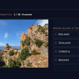
How to play
- Goal
- Know the world’s islands: their shapes, locations, areas, countries and island groups.
- How it ends
- Island Line ends on the third mistake or when the collection runs out; other competitions end after ten questions, placements or pairs.
- Record
- Most correct answers, then fastest time; Area Reserve keeps the most reserve, Matching the fastest time with penalties, separately for each competition and collection.
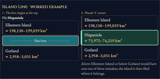
- Island Line: file each island by land area, largest at the top. Choose a gap, then confirm. Three mistakes end the run. Area Order scores ten placements. Overlapping accepted ranges count as equal.
- Outline, Map and Photo: choose the island pictured. Outlines are north-up and fitted individually, rather than drawn at relative land areas.
- Countries: choose a sovereign state administering part of the island. Archipelago: choose an agreed island group; true broader or nested groups are excluded from wrong choices.
- Area Reserve: estimate ten land areas from a 1,000-point reserve. Inside the accepted range costs nothing; farther estimates lose more points.
- Matching Table: match ten island outlines and names. Each incorrect pair adds three seconds.
- The clock waits for question pictures, counts open questions and pauses for reveals. Help and settings keep it running. Leaving or hiding a run makes it practice.
Controls
| Tap / click | Choose a name, placement gap or matching pair |
|---|---|
| 1–8 | Choose an answer |
| Arrow keys · Enter | Move between choices and confirm |
| Digits · Enter | Enter and submit an area estimate |
| H · R · Escape | Help, restart, return |
Questions about this game
Why are some competitions unavailable?
Each collection needs enough reviewed facts and distinct pictured choices. Unknown facts stay outside their competitions.
Does Australia count as an island?
Australia is treated as a continent. Greenland qualifies as an island. Groups, peninsulas and their constituent islands stay separate.
What do the area ranges measure?
Two complete island coastlines are compared after subtracting the same mapped lakes and reservoirs. Unmapped water is not surveyed. Differences up to 15% play as a range; uncertain extents stay outside the area competitions.
Context maps and accepted outline sources: Natural Earth and USGS, public domain. Individual photograph sources, creators and licences are linked next to the images. Gameplay cover contains Calanques of Piana photograph by Myrabella / Wikimedia Commons, CC BY-SA 3.0 (https://commons.wikimedia.org/wiki/File:02_Calanche_Piana.jpg; https://creativecommons.org/licenses/by-sa/3.0), unchanged photograph within a gameplay capture. Title backdrop: patano; https://commons.wikimedia.org/wiki/File:The_colors_from_Ilulissat_-_Greenland._-_panoramio.jpg; https://creativecommons.org/licenses/by-sa/3.0. No ads, SDKs or analytics inside the game.
Watch how to play
About Island Atlas
Explore 416 pictured islands through nine competitions: Island Line, Area Order, Outline, Map, Countries, Archipelago, Photo, Area Reserve and Matching Table. Recognize 406 reviewed outlines and 67 photographs, compare 40 land-area ranges, and compete on 48 rankings across eligible collections.
Facts qualify separately: an island can have an accepted photograph while its area or administration remains outside those competitions. Well-known islands come first; regional collections offer more difficult shapes and places.